WALKING GROUPLeader: Jack Verity
Dates and routes will vary. The location and difficulty of the walk will be notified to members in advance of each walk. At present further information should be obtained from Andy Corrin 434432
Next Walk:
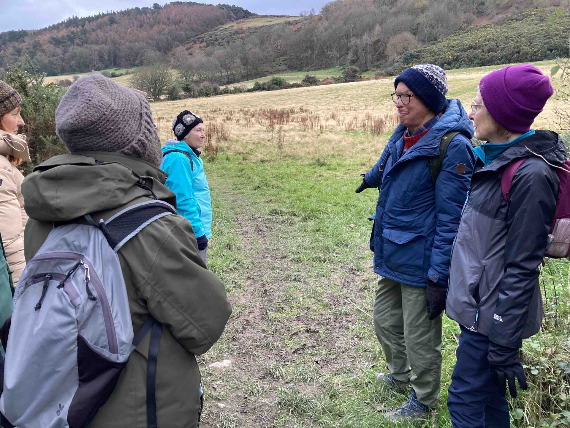
Tuesday 10th March
7.5 mile flattish walk
Start 10:30am
Meet at the rear of Rushen Abbey (near bin store and Abbey Restaurant)
What three words: named.subjecting.excite SC279 703
The walk will be around the perimeter of the airport to Derbyhaven. On to Castletown then following the path of the Silverburn River back to Rushen Abbey.
Be prepared for a few muddy patches from the Engine House at Castletown, back to Rushen Abbey.
One final message is that members or guests on taster sessions participating in walks do so at their own risk and the IOM u3a and walk leaders/organisers can bear no responsibility for accidents. We do not commit to having any qualified First Aider in the group.
Kind regards
Andy Corrin
Walk Leaders:
One final message is that members, or guests on taster sessions, participating on these u3a walks do so at their own risk and the IOM u3a and walk leaders/organisers can bear no responsibility for accidents. We do not commit to having a qualified First Aider in the Group.
IMPORTANT - Jack is organising the October walk and will be the contact in future. We are looking for volunteers who are happy to lead walks over the coming year so that Jack is not left with the burden of organiser and walk leader. Please let Andy know if you are willing to help.
There’s a link to the Walking Group Exchange page, which may interest some members:
https://u3a.us9.list-manage.com/track/click?u=656ad5962b370cc9e2731d1ed&id=e1084ca62c&e=de64e9ad9b
NOTE: Members and guests on taster sessions participating in walks do so at their own risk and the IOM u3a and walkleaders/organisers can bear no responsibility for accidents. We do not commit to having any qualified First Aider in the group. You are encouraged to read the u3a insurance policy overview to clarify cover
| Status: | Active, open to new members |
| Group email: | Walking group |
| When: | Location varies |
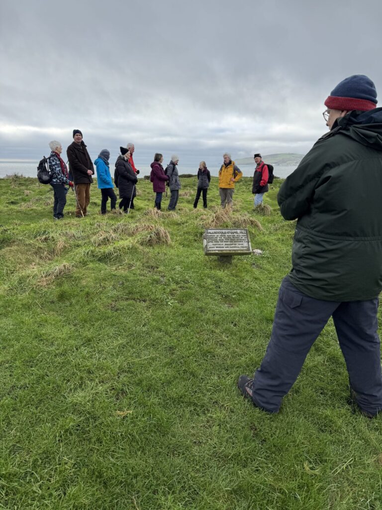
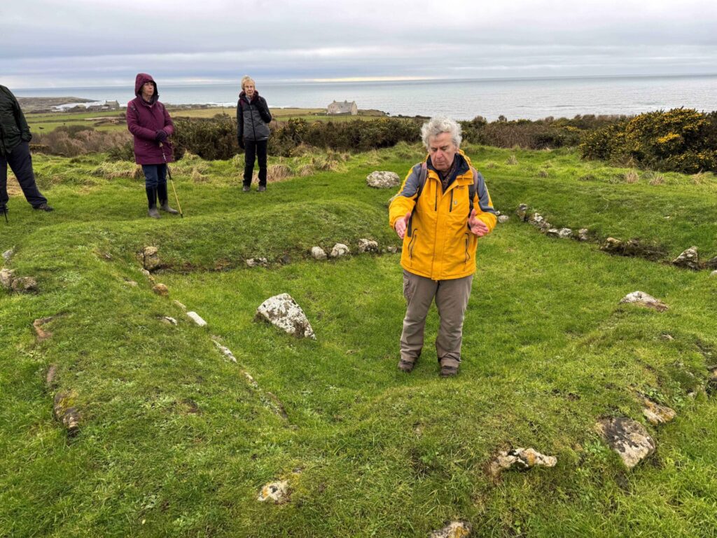
Review of January 2025 Walk
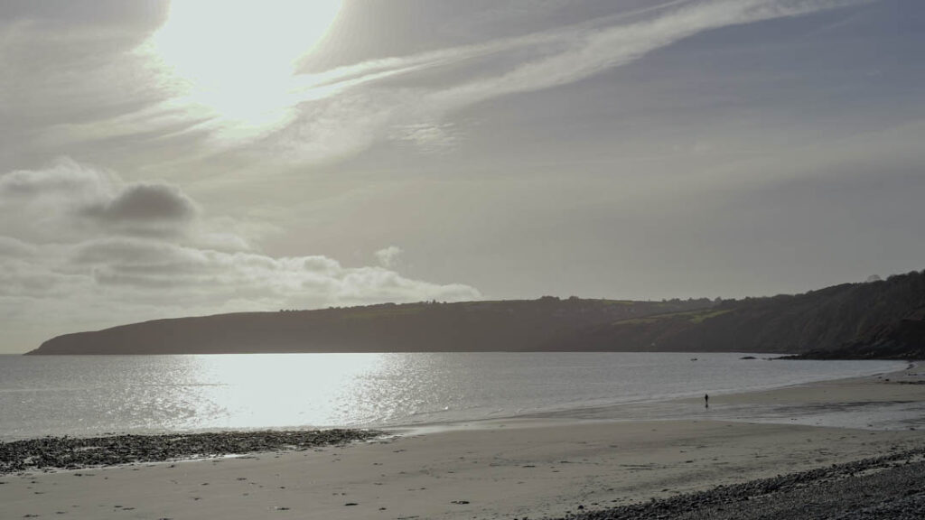
Our January walk took us to Castletown, starting at the Scarlett car park, walking south by
the coastal path. The walk was called Vikings & Volcanoes, during which Jack, our leader,
as well as a Blue Badge guide, gave us lots of information along the way. Luckily the drizzle
didn’t start until we arrived back at the start. Have a look at some of our photos.
Review of October Walk
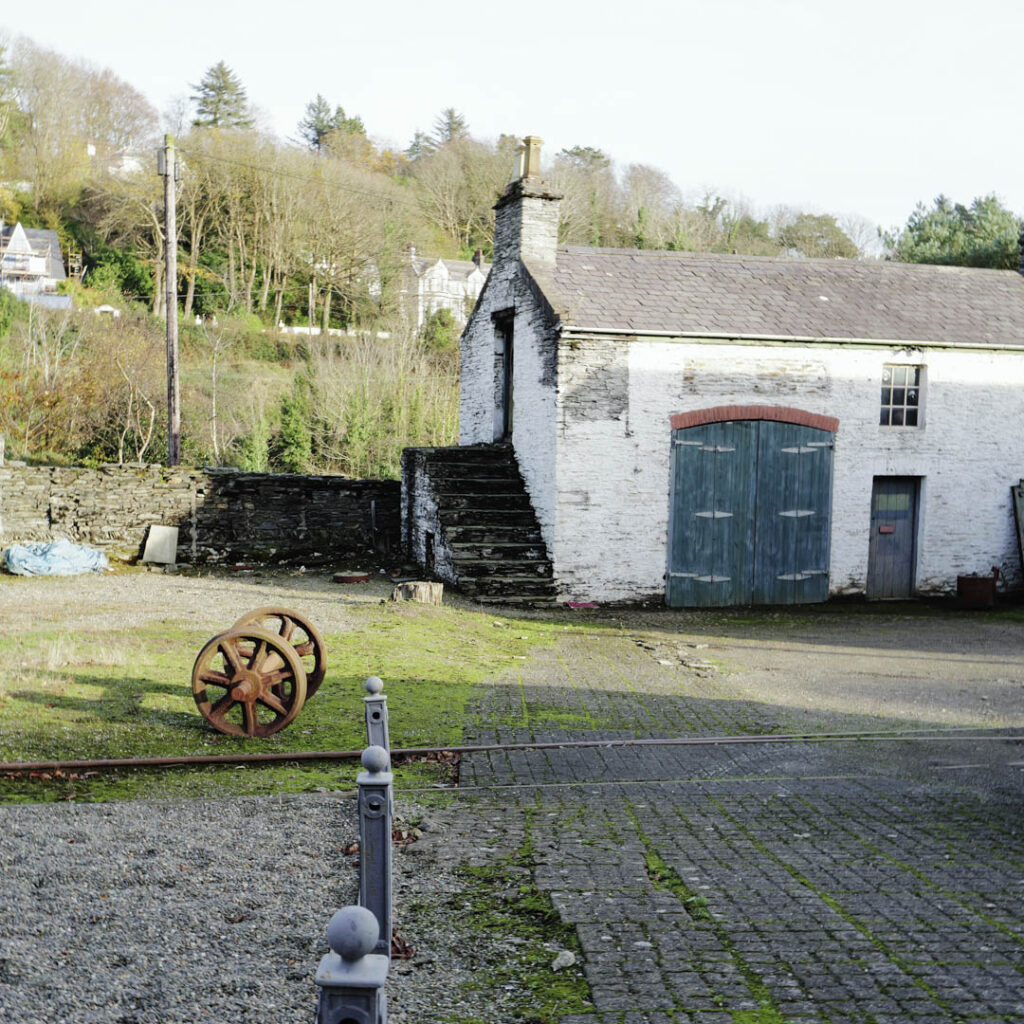
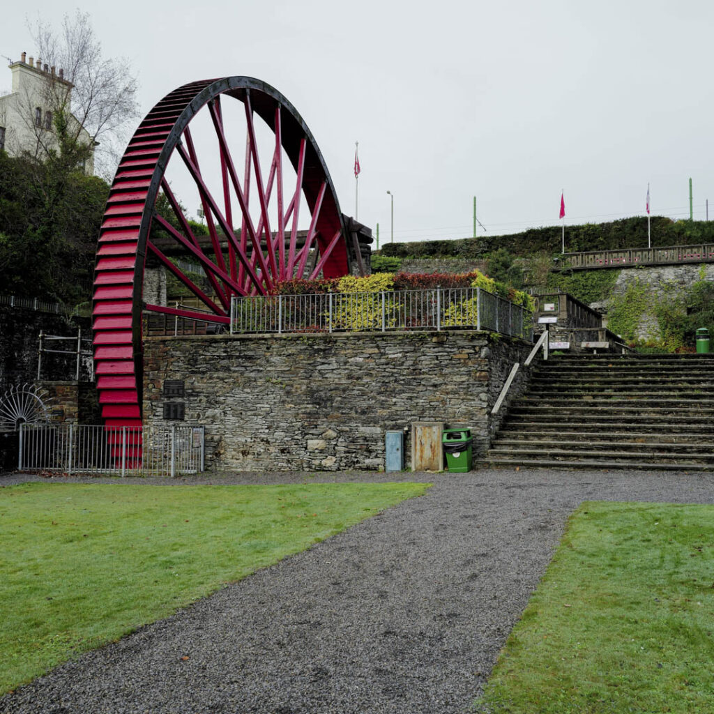
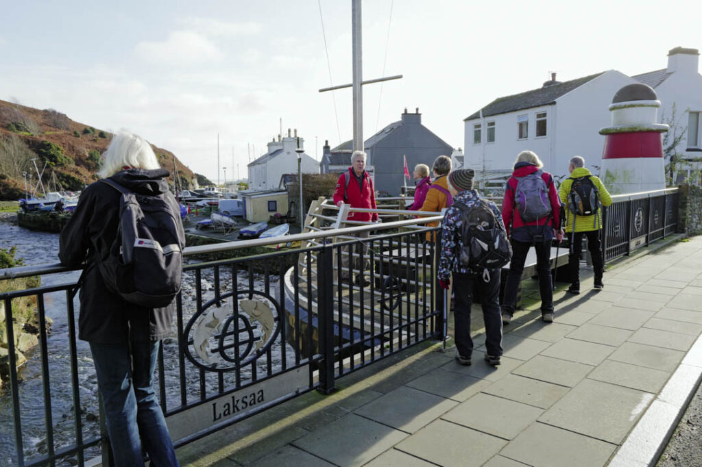
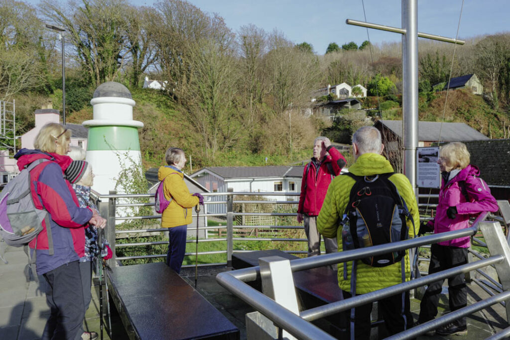
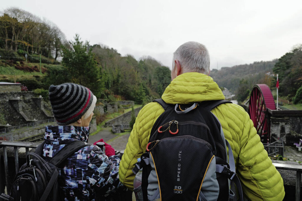
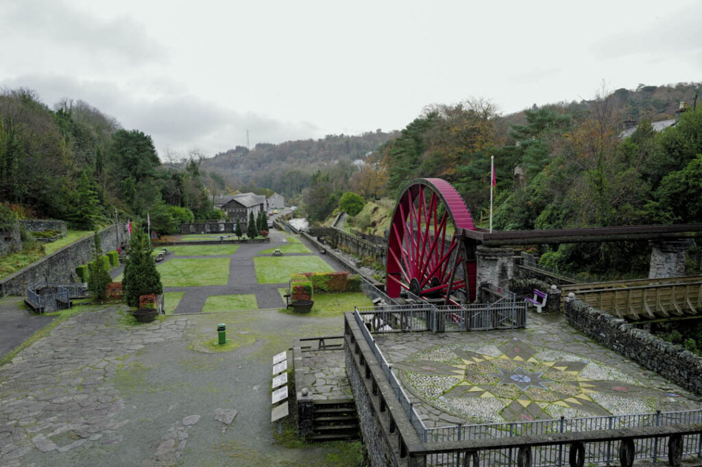
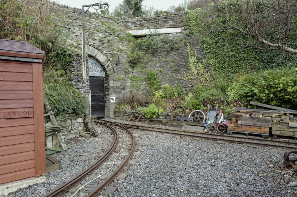
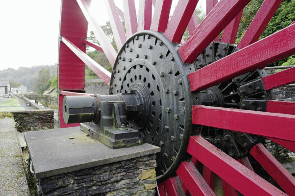
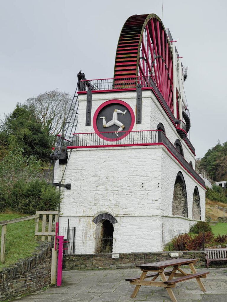
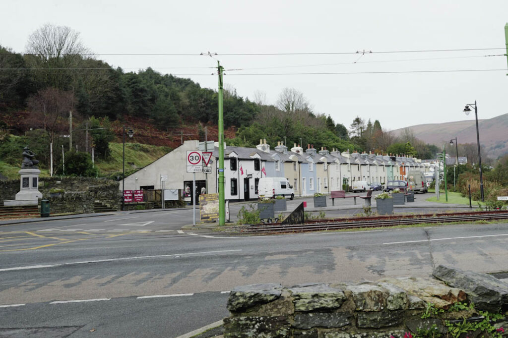
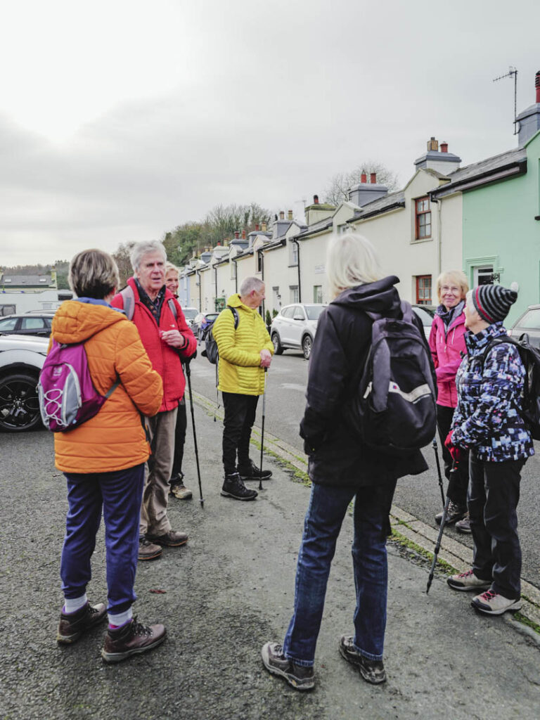
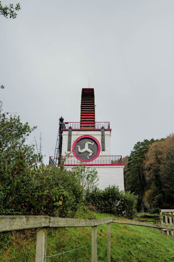
On Tuesday 12th November, with the weather set fair, Jack Verity was at last able to lead us in a walk and talk around the interesting historic places of Laxey. Being a Blue Badge guide, he was a mine of interesting information and kept up a dialogue as we walked up to the Laxey Wheel, which is the largest working wheel in the world, then down through the washing floors and on to the harbour and promenade, the latter we found out was built by the redundant mine workers in six months. By then the sun had come out so we sat at the picnic tables to eat from our lunchboxes, in relative warmth! Up then through Laxey Glen Gardens, hearing about Mr Dumbell , a controversial character - and Henry Bloom Noble, who was a very astute business and a most generous benefactor to the Isle of Man, both during his lifetime and in his will.
This was an interesting variation on walking with the u3a Isle of Man. Our thanks to Jack for a very enjoyable few hours.
My Final Walks with the Group
Our final walk was something of a washout - so different from Saturday. Even so, four of us braved the heavy rain and had a very pleasant walk along the River Neb from St John’s to Peel. No photos though, as mobile phones were packed up tightly in plastic in our rucksacks.
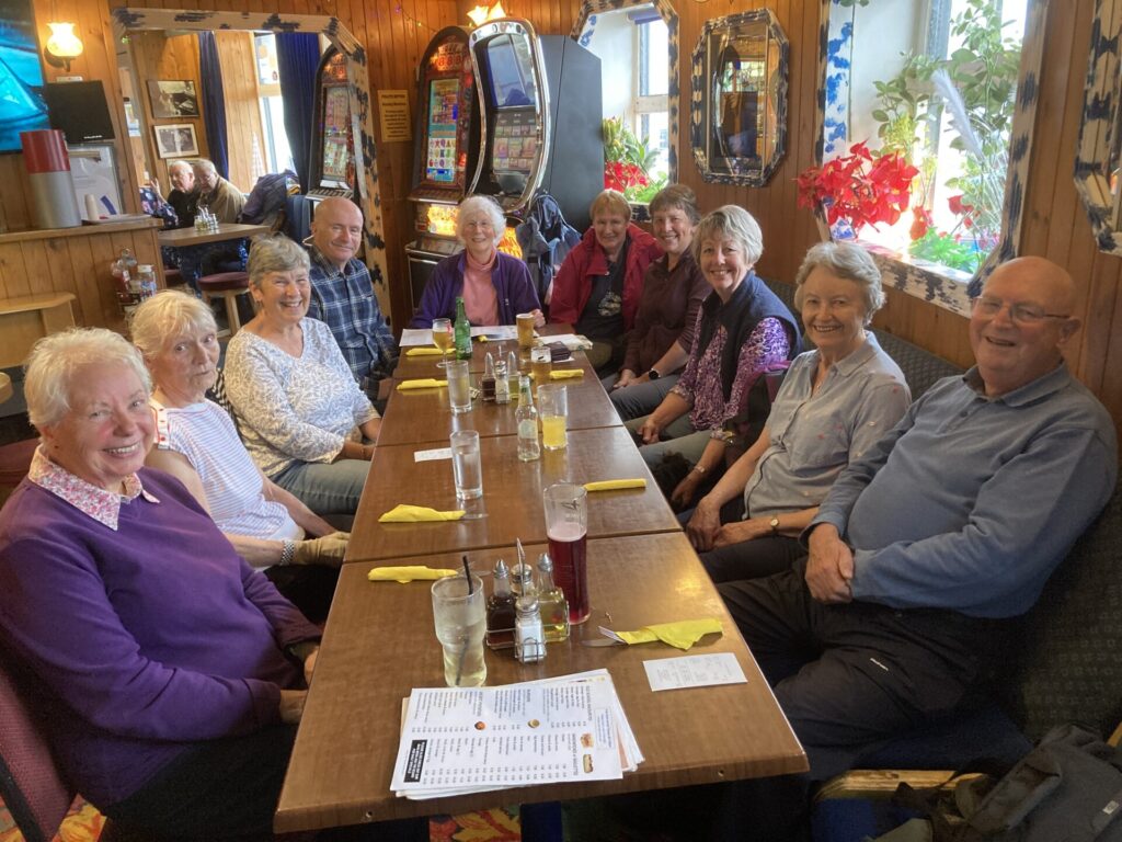
The remainder of our party met us at the Marine Hotel, where we had a lovely meal and time to exchange stories. There was a big surprise when Hazel unexpectedly turned up to say hello … and … goodbye. It was so good to see her and all my other friends. The two days have been the perfect send-off for me and I thank you all for your company and the times we have shared together”.
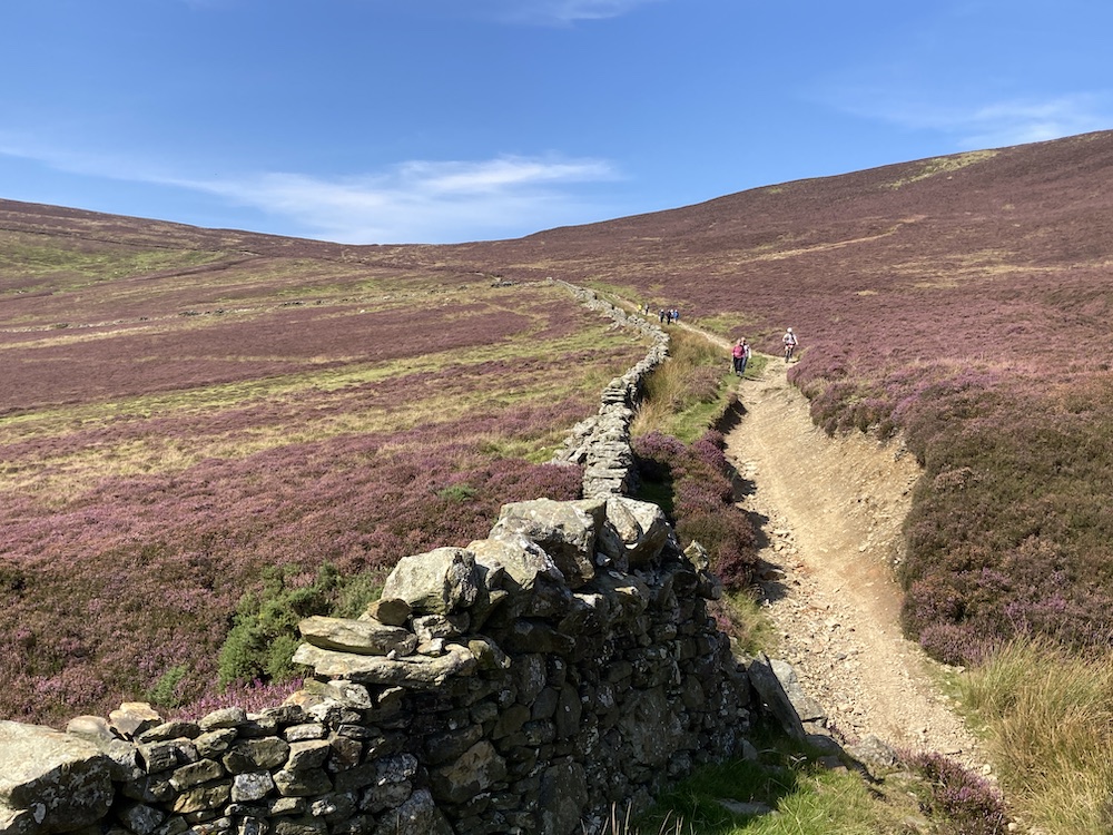
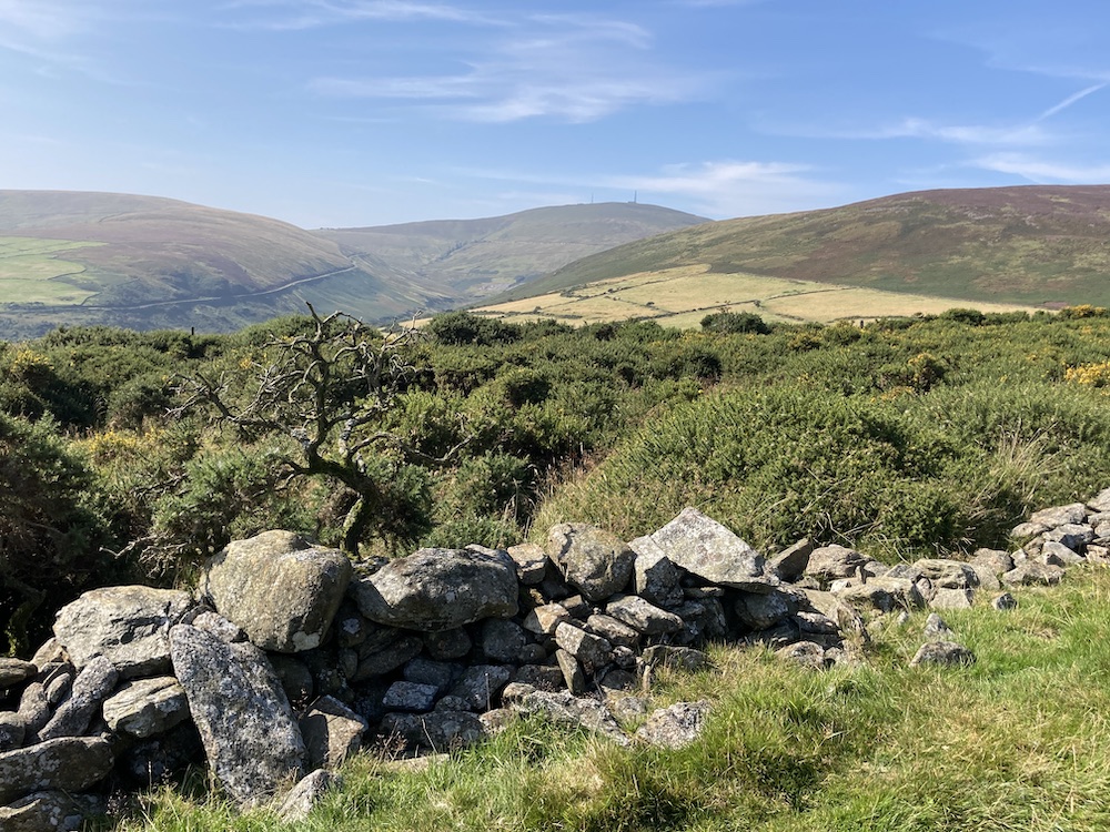
What a lovely day we had for walking from Snaefell to Laxey, taking the higher route back. It was a tad windy on the top and a little misty, but it was warm and sunny, just perfect walking weather. It was good to have so many of the regular walkers back together again for one last time. I shall miss you all, but each and everyone of you have an open invitation to call in and see me should you ever happen to find yourself in Matlock; and if you would like a small U3A group to come over and tackle some of the Limestone Way, I would be delighted to show it to you (or maybe some of the Dark Peaks around Ladybower, or Dovedale in the White Peaks - there is quite a list of lovely places to walk in Derbyshire). I could possibly even be persuaded to do a 'royal' visit to the island once a year and arrange a special walk when I am over to visit friends. But that is for the future...
I am delighted that Jack is taking over the leadership of the group, and hopefully one or two others will be willing to lead the odd walk to ease the burden a little. I enjoyed taking you all around the hills and valleys of the island in the 18 mths I was your leader, and also we have shared many happy stories and friendships over the 11 years I have been in the U3A. Thank you.
DECEMBER
We know that walking in the open air is a wonderful and easy way to keep the mind and body in good health, no matter what age we are, so ever else you do, keep a positive attitude when life is tricky and keep on walking.
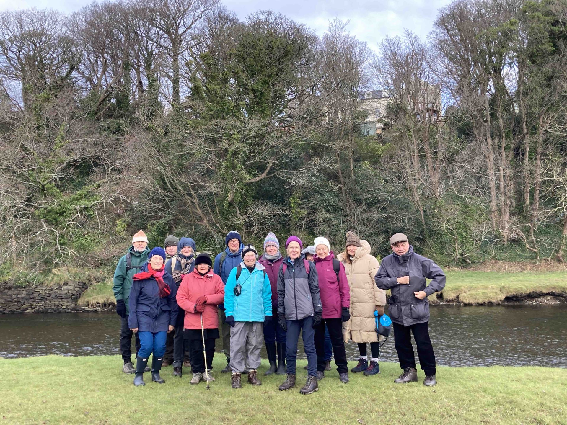
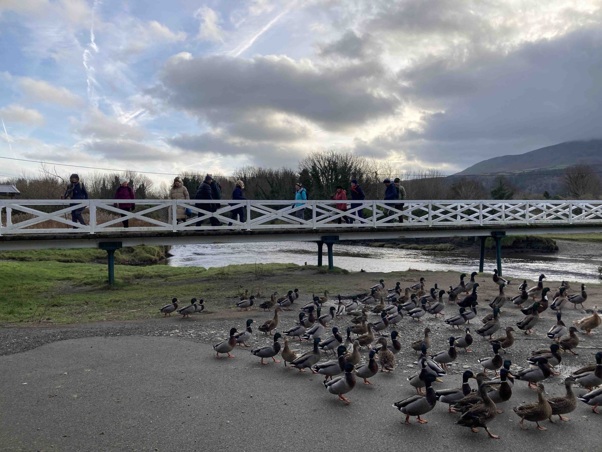
What a super finale we had today to our 2023 walks and my tenure of the group. 14 or us started the morning walk around Poyll Dooey Nature Reserve in Ramsey, which was unavoidably a little muddy and a bit chilly, but still delightful. The river walk is very picturesque, especially at the start, and when you walk through the woods and scrubland you feel as if you are in another world. We crossed the river using the footbridge and the ducks argued with us that this was their domain and not ours, so having walked a short distance along the other side to admire the distant views, we returned back over the bridge and walked a different route back, taking time to admire Poyll Dooey house and imagine what the area must have been like when the earliest part was built in the 17th century.
At that point, a couple of people dropped out and 12 of us went on to Milntown where we were joined by another member of our group for a fantastic lunch, which took rather longer than we had hoped. It was almost 2.45pm by the time 9 of us started the afternoon walk and the light was already beginning to fade. Andrew, true to his word, gave us interesting facts along the way about the planned Hairpin Woodland Park, which will transform the area and provide new habitats for wildlife and experiences for young, old, disabled and bike riders alike in years to come. It is an exciting prospect. Having walked across fields we then had a steady, if fairly steep climb through the woods up to the quarry, where the bottom of it will become the main car park and relieve the congestion currently experienced when trying to park at the Hairpin bend. By this time, it really was becoming quite dark and the leaves covering the steps made the descent a little tricky. But we were all happy, enjoying each other’s company and having a new experience.
There are no more walks planned at present for this group until another Group Leader and particularly Walks Leaders come forward. Andy will probably in touch with the group in due course, but if you would like to be involved in any capacity please get in touch with him or Tony, the Groups Liaison Officer.
May I thank you all for your support, kind words and friendship over the last 15 months while I have been organising the group, and whatever happens with the group there is no excuse but to …. Keep Walking.
Wishing you all a very Merry Christmas and a Happy New Year.
Gill
November Walk
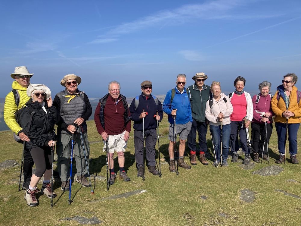
Seven of us had a good 5 mile walk today through the plantation and up South Barrule. It was rather muddy underfoot in places but the sun shone and we had 360 degree views when we reached the top. I pointed out the actual Round Table and we looked at some of the round huts hidden in in ground of the iron age fort. Walking down across the moor, the views were spectacular. I attach (with luck) some photos.
October Walk
Our 'band of brothers' set out for a leisurely walk around Langness on a cool but pleasant day. We were unexpectedly a few members down, due to illness and emergencies, but to compensate another member who we hadn’t seen for a while was able to join us, and what a delight it was to see her. We happy few had a super day, strolling around the coastline, watching the birds – egrets, numerous herons, ducks, oystercatchers, to name a few - and listening to and watching the many, many seals who kept popping up to inspect the visitors in their zoo.
The tide was in, which made it even more pleasurable as we ambled along the coastpath, stopping at various points to see the favourite spot of a local ornithologist, admire the majestic lighthouse formerly owned by the Clarkson family and look up at the Herring Tower. We were very relaxed and took time to have some fun at the foghorn and the gun emplacements, as you can see from the photos.
The western side of Langness has a completely different feel to the eastern side of the peninsula; the western side has the salt marshes, rocky coves and pebbly conglomerate rock and the eastern side has soft undulating grassy banks with mounds of gorse and rocks that jut out at strange angles and steeper rock gradients to the sea. There was barely a soul to be seen when we reached the golf course, or indeed in the golf house restaurant. We almost had it to ourselves. The owners had thoughtfully given us the table that provides the most scenic views of Derbyhaven. The food was very good and we spent almost an hour there, chatting and enjoying each other’s company.
After lunch, we visited the ruined fort on St Michael's Isle (Ellan Noo Mael), also called Fort Island (Ynnys Vaayl). We debated how old the fort was, with its ancient cannons, and I wasn’t far wrong when I guessed it was built around the time of the Armada, judging by the types of cannons dotted all around the outside. Although this building was constructed in 1645 as a defence during the civil war, this fort replaced one previously built by Henry V111 in 1540. The Armada was 1588. At this time, Derbyhaven was a major port on the Isle of Man. After this detour, we followed the road and coast path back to the cars at Hango Hill.
I will be sending out details of our next walk on Wednesday November 8th in a week or so. Hopefully, you will all receive the message and photos this time. There should be several photos attached here of our Langness walk.
September - Visit of Southport u3a walking group
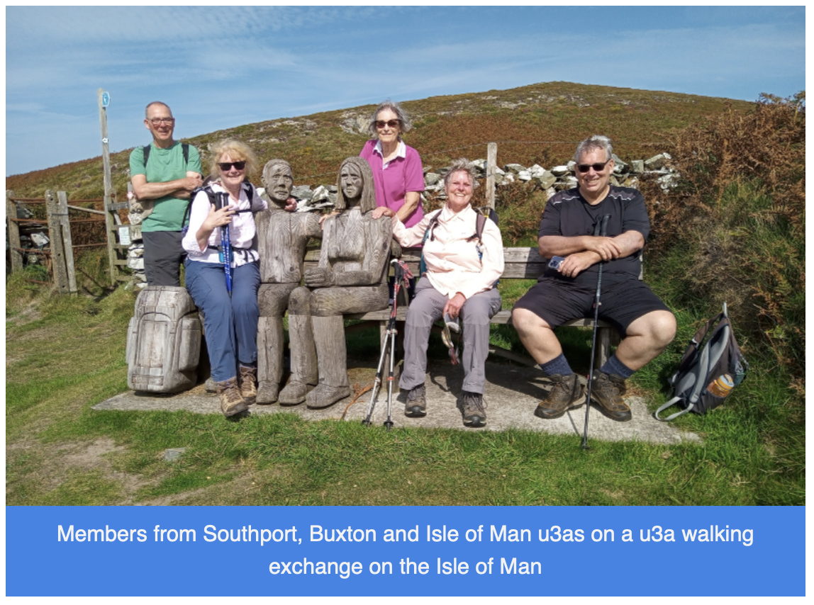
A few months ago the leader of the Southport u3a walking group, Jacky, contacted Gill, our walking group leader, asking if she would consider organising 3 days of walking for their group on their visit to the Isle of Man. Gill set to the task and arranged 3 days of interesting and varied walks – on Tuesday 5 September, taking the tram to the top of Snaefell and walking back down to Laxey; on Wednesday 6 September walking the scenic coastal path from Glen Maye to Peel; and on Wednesday 7 September, a round trip from Port Erin, up through Glen Chass to the chasms, then following the coastal path to the Sound to stop for refreshments, and finally walking the coastal path back to Port Erin. The third day was a longer walk, so a break-off party went from the chasms to Cregneash , then up Meayll Hill to descend via the Stone Circle to the single track tarred road to Port Erin. The weather was amazing for all 3 days, and all went well. Thanks to Gill for organising and leading the first day’s walk; to Dulcie for leading the second day’s walk, and to Mark for leading the third day’s walk, not forgetting the backmarkers – Mark, Andy, Eve and Bob. It was a real pleasure to meet the fifteen members of the Southport Group, who have invited us to Southport any time to join them on some walks, and so that they may return the favour.
August Walk Niarbyl
We had a most enjoyable and varied walk on our first really sunny day since I first starting leading this group almost a year ago! We began by walking through the Keroodhoo plantation, which is a very pleasant path, keeping ourselves in the dappled shade as we made our way downhill. There were a couple of obstacles, such as steeply dropping paths and streams to cross but nothing too daunting. Towards the bottom end of the plantation a new woodland of deciduous trees is being created whilst the everygreen spruces are being removed as part of a community measure to improve the environment. Reaching Barrane, we soon found ourselves crossing over meadows strewn with flowers to greet the footpath on the coast above Whitesands. This path is not seemingly part of the coastal footpath route but is perfectly accessible and provides a super lunch spot where you can sit on rocks, watch the butterflies and listen to the birds circling overhead, all the time gazing wistfully into the distance at the towering cliffs on the southwestern part of the island or watching the canoeists on the open water.
After lunch we followed a grassy but uneven track with overgrown bracken for the next mile of so. In places, it is a little exposed as the cliffs fall away into the sea. We met a lady and her dog from Arnside who had never visited the island but was now smitten by it, as we all are. It was a little tricky crossing the swollen stream at Glion Mooar, and then we had our main uphill section of 300ft or so. We took it steadily, stopping to look at the wild flowers, or just stopping when we wanted a rest. When we reached Eary Cushlin house a few of us were pleased to remove ourselves as we were being bitten by midges and such like, thankfully no ticks though. It was then a flat walk along the track back to the cars. We had had a wonderful day ambling along the coastline and enjoying each other’s company.
July Walk:
Eight of us had a very good walk yesterday along Marine Drive down to Keristal, The Old Fairy Bridge and Pulrose, and almost made it back before we got soaked… but not quite, and only after a stop-off at Quayside for a coffee. This was a gentle walk along the very panoramic old tram roadway, stopping to wave to the passengers on the steam train, then across fields to say hello to the donkeys, continuing down to the packhorse track and the old fairy bridge, that looked absolutely delightful and felt very evocative, and along the lovely Middle River and on the Nunnery footpath. We took it slowly and enjoyed the countryside and the conversations.
I promised the group some information and photos (attached) of Marine Drive in its heyday - thanks to tramwayinfo.com for the photos -so here it is:
Marine Drive was built in the 1890’s initially as a scenic private toll road, but by 1896 construction of the tramway had begun and the full length from Douglas Head to Port Soderick was completed in 1898, with a funicular either end, to enable passengers to avoid the lofty climbs from the beach. As we commented on at the time, where the car park is now at Pigeon Stream, this was the location of the generating station and sheds. There were 12 open-sided double-deckers, catering for 75 people, built by Brush Electrical (I know this company well having passed by it every single day going to High School in Loughborough). One of the ‘cars’ can still be seen at Crich Tramway museum nr Matlock, Derbyshire. Viaducts were built to avoid impossible bends in the rocks, especially at Wallberry and you can still see the remains of the grand stanchions in the gullies as you walk past. The trams operated until WW1, when it closed temporarily. It opened again between the wars, but never resumed after WW2
June Walk
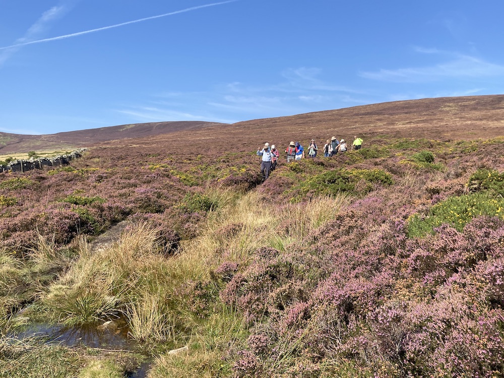
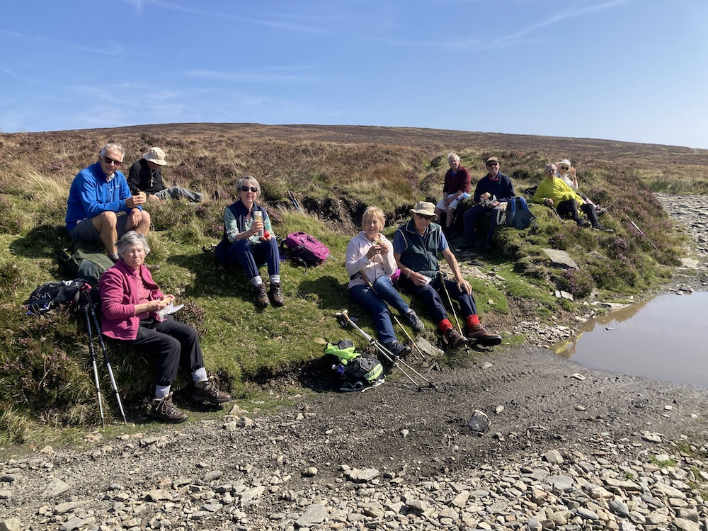
We had a tremendous walk yesterday, with wall to wall sunshine and a light to strong breeze preventing us from getting too hot in this unusually hot June. We started at Brandywell car park (336m) and took the track northwards circumventing the lower reaches of Sartfell, before veering off across the moors to Slieau Freoaghane, our coffee stop at 488m. We had tremendous views all round, even if it was a little hazy. Fiona tolled the bell to let the locals know we had arrived. From here, we followed a grassy track down to the head of the valley then made our way across soft moorland to rejoin the track that leads to Ballaugh. We stopped at the junction with the Kirk Michael path, just short of Slieau Curn* and headed back across open grass and moorland. This was our lunch stop, sitting on a perfectly designed grass bench overlooking Slieau Dhoo* immediately in front of us, with Glenn Dhoo below to our left and the sea in the distance. What a spot for lunch. A few of us contemplated scrambling down to the ravine below for a bit of an adventure, but thought better of it, or indeed, we had a better idea – to organise a ghyll scramble up the stream, which captured a few of our imaginations, so... watch this space. After lunch, it was only a short distance up and over the col, before we reached another track. Being a small group, we decided to extend the walk and took the footpath downhill to Druidale, our lowest point of the day at 250m. We could feel the change in temperature as we descended and the breeze calmed and the afternoon sun became hotter. The Druidale road is delightful to walk along, and preferable to the stony track (if level) that we would have had to walk along had we stayed up higher. We took our time and noticed the plantations being developed on the right and discussed the geological formations on the left. Altogether, it was a delightful day out. Total distance 5.3 miles and 1198ft / 1188ft of ascent/descent.
- Now that I have been able to consult a map, Slieau Curn was the hill to the left and Slieau Dhoo the one in front of us while we had lunch. This detail is not shown on the 1:50000 map.
May Walk - Crosby to West Baldwin
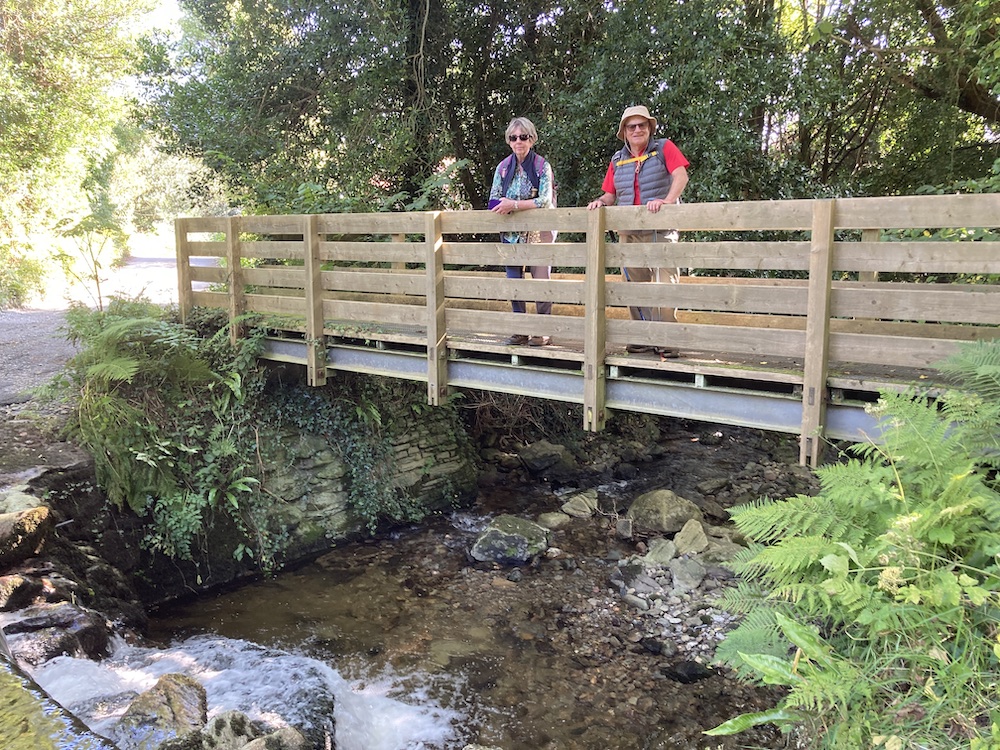
We had a really delightful walk last Wednesday, starting at Crosby and making our way through the gentle countryside to the peaceful hamlet of West Baldwin. For once it was a lovely day, if a tad breezy at times, and we had good views and not too much mud, by my standards. We stopped and looked at views and admired the shire horses, if that is what they were, standing patiently while we talked to them and fussed them. The wild flowers were beautiful; we saw stitchwort, red campion, lady's smock amongst the wild garlic, bluebells and primroses. We were even fortunate to see an orange-tip butterfly flitting about in the undergrowth beside the river Glass, when we stopped for lunch. One or two people commented that this was a new walk for them, or certainly some of the paths were new to them. One of the these was an ancient route that took us through a small ford, although some kind person has built a one person bridge just for walkers as you can see on the photo where Andy is posing for us. Another path, close to Glen Vine, had a real treat in store once we had negotiated the tricky stiles, (see the lean-to stile) as in a remote woodland was a fairy glen with all sorts of activities for children to enjoy while camping out. This was a totally unexpected surprise and one which we all enjoyed. Our walk finished with the the final mile along the heritage trail, a nice easy trail these days with no muddy puddles to jump over any longer, but now a somewhat less interesting railway path since it has been upgraded.
March Walk - Tholt Y Will, Sulby Reservoir, Ballaskella
I was sorry to miss the last walk. Here is Dulcie's wonderfully evocative report, which makes me even more sad to have missed it....
"We had an enjoyable walk (starting at the Sulby Claddaghs), sunny but cold. On our way up to the reservoir we passed a small stream which had frozen into icicles. As we climbed, we came out into the sunshine which stayed with us most of the walk. Due to the dry winter, the reservoir is noticeably low for the time of year. If the summer is dry, we’ll certainly have a hosepipe ban. The reservoir was opened in 1983 by Princess Alexandra.
Dulcie pointed out Druidale Farm sitting just above the reservoir. This was the site of a gruesome murder in 1991. In the other direction, above the narrow arm of the reservoir is the isolated cottage, Lhergy Rhennie, the scene of another murder in the 1930s. Towards the end of the walk we visited the tholtan, Ballaskella, the scene of yet another murder in the 1880s. That’s enough murders! (ps. GL - and here's me thinking we live on a safe island!)
After the reservoir we had a one-mile uphill climb to reach the Millennium Way. En route we passed an Iron Age rampart and ditch construction which lies on either side of the road. It blends into the landscape so it is only when on foot that one notices it. Having reached the Millennium Way, we turned onto it, northwards, for a short distance, before taking a wide forestry track. We stopped for our snack at a break in the trees which gave us a good view of the reservoir in the distance.
The heathery track brought us eventually to an open hillside which had been sparsely planted with young trees. Unfortunately they had been neglected and were either dead or suffering in their plastic protectors. Ballaskella, a large tholtan, hangs above the Sulby valley. We had a look around and then took the very steep zig-zag track to the valley floor, crossing over the pretty Ballaskella bridge. A short, sharp climb brought us up to the road and in another 5 minutes we were back at the cars. 5.8 miles
Thank you Dulcie for leading this super walk.
February Walk - Glen Helen Walk
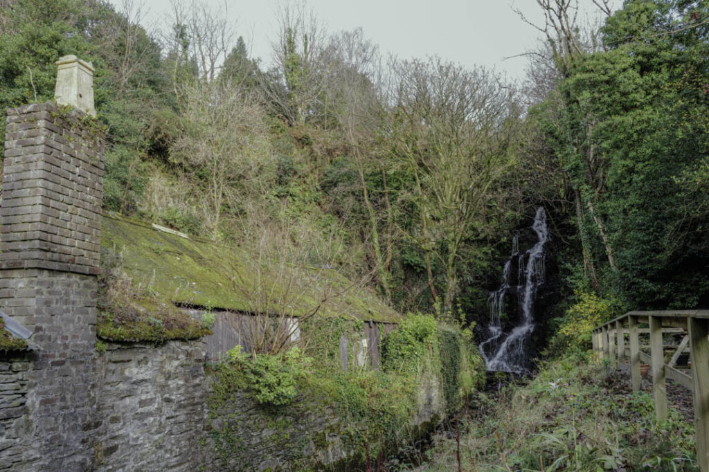
We had a good walk up Glen Helen and on to the top of Beary Park on Wednesday with 12 members attending, including a U3A lady from Norwich visiting the island. We were very thankful that we had more 'normal' weather for once. There wasn't as much water in the Rhenass Waterfall as I had experienced previously, but it was still good to see and the glen looked as lovely as ever in its winter clothes. We had a look round the tholtan in the plantation and tried to imagine what it was like living there without the trees that now surround it, and then we had a steady climb to the open top, where it was somewhat cool and windy. We didn't spend too much time up there and then descended on a different, fairly steep path into the western side of the plantation. Once back at Swiss Cottage (now called The Lodge) a few of us had a very pleasant stop at the cafe, with its roaring log fire keeping us warm. Thank you all for attending and I hope your knees didn't suffer too much with the steep descent!
January Walk
New Year’s Day – and What a Day
We met at Round Table as planned and the weather was already dull. I could see rainclouds bubbling up in the distance and I knew this was the calm before the storm. I did offer my alternatives but the group would not be discouraged and we began our ascent of South Barrule. There was no snow today, but in its place was water – everywhere, and it was hard to avoid placing one’s foot in one puddle or another. Even so, it was easy walking and a pleasant climb.I forgive the many of you who decided to abandon thoughts of a walk this New Year’s Day. The weather forecast was not great – we could expect at least a few short, sharp showers, but some clear spells too, and given there is nowhere to take shelter on this walk I imagine this might have put a few people off, especially as it was hailing cats and dogs in some parts of the island I gather. Even I was wondering whether this was a sensible route to undertake today, and in my head I had prepared a few other options with more cover or escape routes, if required: Glen Maye, Port Soderick, Marine Drive or total abandonment of the walk. One of my trusty walkers who is usually game for anything rang up to sorrowfully back out at the last minute – you know who you are – which left just three hardy fellows including me to climb South Barrule.No sooner had we started when I got a call from my son, then another from my friend and a text from my daughter as my Garmin watch was under the impression that I had had an ‘incident’ and it promptly notified my emergency contacts, detailing exactly where I was (well, close..) and demanding that they contact me to see if I was all right. Quite what I had done to initiate this technical emergency response I don’t know as I had not had a fall, neither had I severely knocked my watch, but at least I know the system works! We continued up South Barrule with Andy leading the way while Eve and I chatted. Then came the rain, and the mist – not quite enough to consider it to be ‘fog’ – engulfed us as we reached the trig point. To be fair, there was the tiniest glimmer of sunlight at this point for which we were thankful. It was a little breezy on the top, but for the first day of the new year, it was at least fairly mild, though a glance to the skies indicated it was not mild enough to stop for a coffee at this point. From here, it was all downhill, trampling over the gorse and heather to avoid the slippery, stony and wet paths whenever possible. It may not sound great but I really was enjoying the walk and the company despite the rain, which would stop every now and again and afford us views into the distance, so I was able to point out the longer route we could take if the rain would cease. Um, yes, that was quite a big ‘if’. On reaching the road, the decision whether to extend the walk was unsurprisingly made by the weather which turned really nasty for the rest of the walk back to the car. We had chosen to walk along the road rather than take the longer detour, but there was no shelter here at all, and the rain lashed relentlessly in our faces for 1.75 miles. I didn’t take any photos at this point – rain doesn’t show up on an iphone – but stepped up the pace a little and considered humming a merry song. We were drenched, thirsty and hungry, but still cheerful, as how else should you spend New Year’s Day but with a typical walk on the Isle of Man.